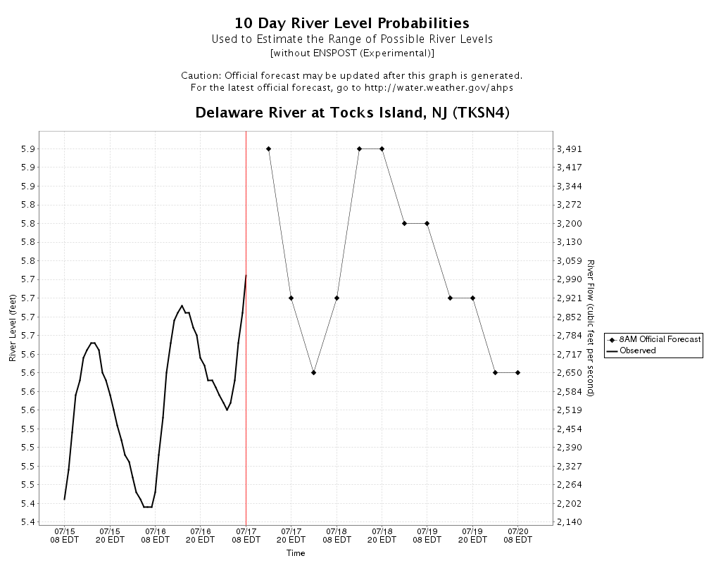
Delaware River at Tocks Island
Last
6.21ft
6.21ft
Chg
-0.36 in
-0.36 in
High
7.2ft
7.2ft
Low
6.3ft
6.3ft
| Forecast Issued Time: | 01/14/26 02:24 PM |
| Last Observed: | 6.21 01/14/26 11:15 PM |
| High Predicted: |
7.20 01/17/26 06:00 AM +0.99 FT (11.88 IN) |
| Low Predicted: | 6.30 01/15/26 06:00 AM |
| Flood stages for this site | |
|---|---|
| Major | 25 ft |
| Moderate | 23 ft |
| Minor | 21 ft |
| Action | 20 ft |
| Recent Crests | |
|---|---|
| 1/25/2018 | 20.08 Preliminary values subject to further review |
| 9/9/2011 | 24.95 |
| 8/29/2011 | 23.21 |
| 3/12/2011 | 22.88 |
| 3/7/2011 | 20.54 |
| 6/28/2006 | 33.87 |
| 4/3/2005 | 33.24 |
| 9/19/2004 | 30.34 |
| 1/20/1996 | 28.4 |
| 3/16/1986 | 24 |
| 5/30/1984 | 21.77 |
| 6/30/1973 | 23.8199996948242 |
| 6/24/1972 | 17.31 |
| 8/19/1955 | 37.4 |
| Historic Crests | |
|---|---|
| 37.4 | 8/19/1955 |
| 33.87 | 6/28/2006 |
| 33.24 | 4/3/2005 |
| 30.34 | 9/19/2004 |
| 28.4 | 1/20/1996 |
| 24.95 | 9/9/2011 |
| 24 | 3/16/1986 |
| 23.8199996948242 | 6/30/1973 |
| 23.21 | 8/29/2011 |
| 22.88 | 3/12/2011 |
| 21.77 | 5/30/1984 |
| 20.54 | 3/7/2011 |
| 20.08 | 1/25/2018 Preliminary values subject to further review |
| 17.31 | 6/24/1972 |
| Impacts | |
|---|---|
| 21 | Approach roads to the Shawnee Inn flood. Route 209 begins to flood. |
| 22 | Many local roads that connect to Route 209, River Road, and other park roads are closed. |
| 23 | Route 209 is closed. |
| 25 | Campsites in Worthington State Forest in New Jersey flood. |
| 30 | All delaware water gap recreation resources are impacted, including natural and cultural resources, archeological sites, visitor use facilities, and infrastructure such as roads, bridges, and utilities. |
